The Best Hikes in Rocky Mountain
Thirteen trails with real NPS figures — plus the mileage catch that means half the guides out there are quoting you half the hike, and the permit question nobody sorts out before the trailhead.
NPS lists many of these one way, not round trip.
The park’s master trail table gives a lot of its distances as one-way mileage. Most blogs copy the number straight across and label it round trip — so a hike they call 1.8 miles is actually 3.6.
We’ve shown both columns below, and left a dash where NPS only publishes one of them. The gaps are real, and they’re the point: the park doesn’t state these consistently, so check the basis before you trust any number, including ours.
📍 The permit question comes first
Which permit you need depends on which trailhead you’re driving to, not how long the hike is. The Bear Lake Road corridor trails need the harder of the two reservations, and the outlying trailheads still need one even though they have no entrance gate.
Sort that out before you pick a trail — our timed entry guide covers both permits in full.
Which Permit Each Trailhead Needs
In season, during reservation hours
| Trailhead | Trails | Permit |
|---|---|---|
| Bear Lake | Bear Lake, Nymph, Dream, Emerald | Timed Entry + Bear Lake Road |
| Glacier Gorge | Alberta Falls, Sky Pond | Timed Entry + Bear Lake Road |
| Sprague Lake | Sprague Lake loop | Timed Entry + Bear Lake Road |
| Longs Peak | Chasm Lake, Keyhole Route | Timed Entry — outlying area |
| Lumpy Ridge | Gem Lake | Timed Entry — outlying area |
| Wild Basin | Ouzel Falls | Timed Entry — outlying area |
| Lily Lake | Lily Lake loop | Timed Entry — outlying area |
| Deer Ridge Junction | Deer Mountain | Timed Entry |
The outlying areas surprise people. NPS applies timed entry wherever you arrive by vehicle during reservation hours, and specifically names Lily Lake, Longs Peak, Lumpy Ridge, Wild Basin, East Inlet and North Inlet. No gate does not mean no permit.
Every Trail, Both Ways
Shortest first — a dash means NPS publishes only the other figure
| Hike | Trailhead | One way | Round trip | Elevation |
|---|---|---|---|---|
| Bear Lake | Bear Lake | Loop | ~0.5–0.6 mi | Minimal — NPS: Easy |
| Sprague Lake | Sprague Lake | Loop | 0.8 mi | Flat |
| Lily Lake | Lily Lake | Loop | 0.8 mi | NPS: Easy — gain not published |
| Nymph Lake | Bear Lake | ~0.5 mi | ~1 mi | ~225–230 ft |
| Alberta Falls | Glacier Gorge | ~0.8 mi | ~1.6 mi | Modest |
| Dream Lake | Bear Lake | ~1.1 mi | ~2.2 mi | ~425–475 ft |
| Gem Lake | Lumpy Ridge | ~1.6 mi | ~3.2 mi | ~1,000 ft |
| Emerald Lake | Bear Lake | ~1.7–1.8 mi | ~3.4–3.6 mi | 605 or 771 ft — see below |
| Ouzel Falls | Wild Basin | ~2.7 mi | ~5.4 mi | ~950 ft |
| Deer Mountain | Deer Ridge Junction | — | ~6.1 mi | 1,083 ft — NPS: Hard |
| Chasm Lake | Longs Peak | 4.2 mi | ~8.4 mi | 2,360 ft |
| Sky Pond | Glacier Gorge | 4.9 mi | ~9.8 mi | ~1,700 ft |
| Longs Peak — Keyhole | Longs Peak | 8 mi | ~16 mi | ~4,885 ft — see warning |
NPS assigns difficulty ratings to some of these and not others. Where it does — Easy for Bear Lake and Lily Lake, Hard for Deer Mountain — we’ve quoted the park’s own word. Where it doesn’t, we’ve left it blank rather than invent one.
Emerald Lake: 605 feet, or 771?
NPS publishes the elevation gain to Emerald Lake as roughly 605 feet on one page and 771 feet on another. That’s a 27% spread on the most popular hike in the park.
We’re reporting both rather than averaging them or quietly picking the friendlier one. It’s a big enough difference to change who attempts it — and at 10,000 feet, 166 feet of climbing is not a rounding error.
The smaller inconsistencies elsewhere — a tenth of a mile here, forty feet there — we’ve just taken from the current operational NPS page without comment. This one is different.
Where to Start
Four honest recommendations by how much day you’ve got
An hour — Bear Lake, Sprague Lake or Lily Lake
All three are flat loops under a mile. Sprague Lake is the quiet pick: the divide reflects in it on a still morning, and it’s the easiest big view in the park. Bear Lake is busier because it’s the trailhead for everything else.
A morning — Dream Lake, or push on to Emerald
The classic. One trail climbing from Bear Lake past Nymph, then Dream, then Emerald, and you can stop at any of them. Dream at ~2.2 miles round trip is the sweet spot for most first-timers, especially on day one at altitude.
Half a day, somewhere quieter — Ouzel Falls or Gem Lake
Ouzel Falls in Wild Basin is ~5.4 miles round trip through a corner of the park most visitors never reach. Gem Lake at Lumpy Ridge is shorter at ~3.2 miles but climbs about 1,000 feet, with big views back over Estes Park.
Both are outlying trailheads, so check the permit table above.
A full day — Sky Pond or Chasm Lake
Sky Pond is ~9.8 miles and about 1,700 feet from Glacier Gorge, and it’s the most rewarding long day in the corridor. Chasm Lake is ~8.4 miles and 2,360 feet, sitting directly under the east face of Longs Peak.
Both finish above treeline, which makes the storm timing below non-negotiable rather than advisory.
Longs Peak is not a hard day hike. It’s a mountain.
The Keyhole Route runs roughly 16 miles round trip with about 4,885 feet of gain to a 14,259-foot summit, and NPS treats it as a serious mountaineering objective rather than a long trail.
Weather, lightning, snow, ice, exposure, route finding and altitude all matter. NPS’s guidance for Longs Peak specifically is to be back below treeline by around midday when there’s any thunderstorm risk — which means starting in the dark.
It’s in the trail table because leaving it out would be strange. It gets this box because putting it in a list next to Emerald Lake is how people talk themselves into it. If you’re going, plan it as its own trip.
Altitude and the Afternoon Storms
The two things that actually change your day here
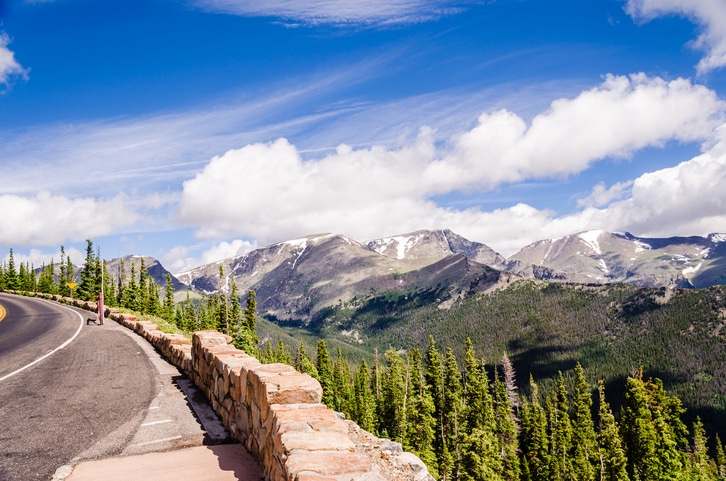
NPS warns that many visitors experience altitude-related symptoms here, and that physical activity is simply more demanding at elevation — particularly for anyone arriving from close to sea level. Anyone with respiratory or cardiovascular concerns should talk to a doctor before high-elevation activity.
| Where | Elevation |
|---|---|
| Beaver Meadows Visitor Center | 7,840 ft |
| Bear Lake | 9,475 ft |
| Alpine Visitor Center | 11,796 ft |
| Trail Ridge Road high point | 12,183 ft |
| Longs Peak summit | 14,259 ft |
Our advice, not a park rule: keep your first day’s hiking short. Every hike from Bear Lake is under four miles round trip, which makes that corridor a sensible first day whether or not the altitude is bothering you.
The storm rule matters more. NPS repeatedly tells hikers to start high-elevation hikes early and get below treeline before afternoon thunderstorms develop. They build fast over the high country in summer and there is nowhere to shelter above the trees. Sky Pond, Chasm Lake, Deer Mountain and anything on Trail Ridge all sit in that category.
Parking, and why a permit doesn’t fix it
A timed-entry reservation does not guarantee a parking space. NPS says so plainly, and Bear Lake and Glacier Gorge both fill early — which between them account for seven of the thirteen hikes on this page.
The fix is the Park & Ride. Leave the car there and take the free Bear Lake Road shuttle, which runs every 10 to 15 minutes in season. You lose nothing but the illusion of control.
If you’re coming from town, the Hiker Shuttle runs from the Estes Park Visitor Center to the Park & Ride on its own separate reservation, and skips the corridor parking problem entirely.
Check whether a distance is one way before you trust it. At 10,000 feet, finding out halfway is an expensive way to learn.”
Before You Hike
- Start early. It solves three problems at once — parking, crowds and afternoon storms.
- Check the distance basis. NPS’s master trail table often lists one-way mileage. Doubling a number you assumed was round trip is the most common planning error here.
- Trail Ridge Road is seasonal — generally about the last week of May to mid-October — so anything reached from it has a season too.
- Snow lingers high into summer. The upper trails hold it long after the lakes have thawed; check current trail conditions rather than assuming.
- Wildlife distances: NPS asks for at least 75 feet from wildlife generally and about 120 feet from black bears, moose and mountain lions. If an animal changes its behaviour because of you, you’re too close.
- No permit is needed to day hike — only to drive in. Backcountry overnights are a separate wilderness permit.
Rocky Mountain Hiking FAQ
What’s the best hike in Rocky Mountain National Park?
For most first-time visitors, the Bear Lake to Emerald Lake trail. One path climbs past Nymph, Dream and Emerald, so you can turn around at any of the three. Dream Lake at about 2.2 miles round trip is the sweet spot; Emerald is about 3.4 to 3.6 miles.
Are NPS trail distances one way or round trip?
It varies, and that’s the problem. The park’s master trail table often gives one-way mileage while individual pages give round trip. Always check which you’re looking at — it’s why a hike described as 1.8 miles can turn out to be 3.6.
How much elevation gain is Emerald Lake?
NPS gives it as roughly 605 feet on one page and 771 feet on another. We report both rather than pick. At around 10,000 feet that 166-foot difference is worth knowing about before you set off.
Do I need a permit to hike here?
Not to hike — only to drive in during the reservation season. Which permit depends on the trailhead: Bear Lake, Glacier Gorge and Sprague Lake need Timed Entry + Bear Lake Road; Longs Peak, Lumpy Ridge, Wild Basin and Lily Lake need plain Timed Entry even though they have no entrance gate. Backcountry overnights need a separate wilderness permit.
What’s the easiest hike with a big view?
Sprague Lake — a flat 0.8-mile loop with the Continental Divide reflected in it. Bear Lake and Lily Lake are similarly easy loops. None of the three require any climbing.
Can you hike Longs Peak in a day?
People do, but NPS treats the Keyhole Route as a mountaineering objective rather than a day hike — roughly 16 miles round trip, about 4,885 feet of gain, and a 14,259-foot summit with real exposure and route finding. NPS recommends being back below treeline by around midday when thunderstorms are a risk, which means starting in the dark.
How bad is the altitude for hiking?
Real enough to plan around. Bear Lake is at 9,475 feet before you start climbing. NPS warns that many visitors get altitude symptoms and that everything is harder up here, especially coming from near sea level. Our advice, not the park’s: make day one short.
When do the afternoon storms start?
NPS’s guidance is to start high-elevation hikes early and be below treeline before afternoon thunderstorms develop. For Longs Peak specifically it recommends being back at treeline by around midday. Above the trees there is nowhere to shelter, and the storms build quickly in summer.
Will I get a parking space at Bear Lake?
Not reliably, and a timed-entry reservation does not guarantee one. NPS warns that Bear Lake and Glacier Gorge both fill early and recommends the Park & Ride and the free shuttle instead. Arriving before 5 AM is the other answer.
Which trails are good with kids?
The three flat loops — Sprague Lake, Bear Lake and Lily Lake, all under a mile. Nymph Lake at about a mile round trip and Alberta Falls at about 1.6 are the natural next step. Remember everyone is working at 9,500 feet, so what feels easy at home won’t here.
Fitting these into a trip?
Our 3-day Rocky Mountain itinerary builds the Bear Lake corridor into day one and leaves day three open for a longer hike, with a free printable PDF and an interactive map. Sort the permits first with the timed entry guide, then see the tours worth paying for — including the one that doubles as a permit.