2-Day Bryce Canyon Itinerary
Sunrise over the hoodoos, the park’s best hike, and the 18-mile scenic drive most visitors skip — Bryce is small, and two days is genuinely enough.
⚠️ Trail closure — check before you go
Heavy rainfall on July 29, 2026 caused extensive damage to the Wall Street side of the Navajo Loop, and it remains closed while repairs are underway. The Two Bridges side is open, so the Queen’s Garden–Navajo loop still works — this itinerary routes you that way. Check the park’s current conditions page before you travel.
Quick Facts — Before You Go
- Entrance fee: $35/vehicle, valid 7 days. Card only — the park doesn’t take cash. Non-U.S. residents 16 and older pay an additional $100/person as of January 1, 2026.
- The shuttle is optional. Unlike Zion, you can drive the entire scenic road year-round. The free shuttle runs roughly April–October and is useful mainly for skipping viewpoint parking.
- Elevation: the rim sits at 8,000–9,115 ft. Altitude is the thing most visitors underestimate here.
- Best hike: the Queen’s Garden–Navajo Combination, 2.9 miles and 625 ft of gain, 2–3 hours
- Gateway airports: Las Vegas (LAS) or Salt Lake City (SLC), both about 4 hours. Cedar City (CDC) is roughly 1.5 hours.
- Where to stay: Bryce Canyon City is under five minutes from the gate — see our full Bryce lodging guide for picks in every price range, plus glamping
- Coming from Zion? It’s about 1.5–2 hours between the two parks — see our Zion guides.
🐎 Top Experiences — Guided Tours in Bryce
Horseback rides down among the hoodoos, guided sunrise hikes, and stargazing trips under certified dark skies. Tap any tour to check dates and book direct.
As an affiliate partner, we may earn a commission on bookings made through these links — at no extra cost to you.
Two days is the right amount
Bryce is 56 square miles and the main amphitheater is compact enough to see properly in a morning. Two days gets you a sunrise, the signature hike, the full scenic drive, and a night under some of the darkest skies in the country — without padding.
🗺️ Trip Route Map
Every stop from both days, color-coded by day. Tap any pin for details, and use the layers menu in the top-left to toggle each day on or off.
The Amphitheater
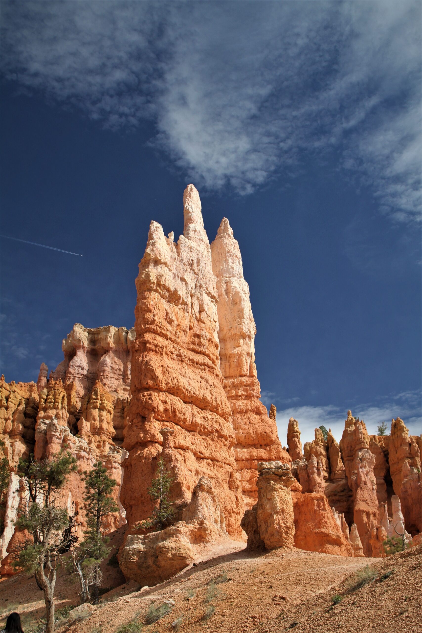
Sunrise at Sunrise Point
The amphitheater faces east, so first light hits the hoodoos straight on and the whole bowl turns orange at once. Park at the lodge and walk over. Bring coffee and a jacket — it’s cold at 8,000 feet even in summer.
Best Photo SpotQueen’s Garden to Navajo Loop
The park’s own most-recommended hike, and the one it gives first-timers. Descend Queen’s Garden from Sunrise Point, walk among Queen Victoria and the spires on the amphitheater floor, then climb the Navajo Loop switchbacks up to Sunset Point.
Don’t MissRim Trail Back to Sunrise Point
A flat, paved half mile along the rim with the amphitheater open below you the whole way. It closes the loop and it’s the best casual view in the park.
Easy AdventureLunch at Bryce Canyon Lodge
The historic dining room, or grab sandwiches from the General Store next door. Either way, eat inside the park — driving out costs you half an afternoon.
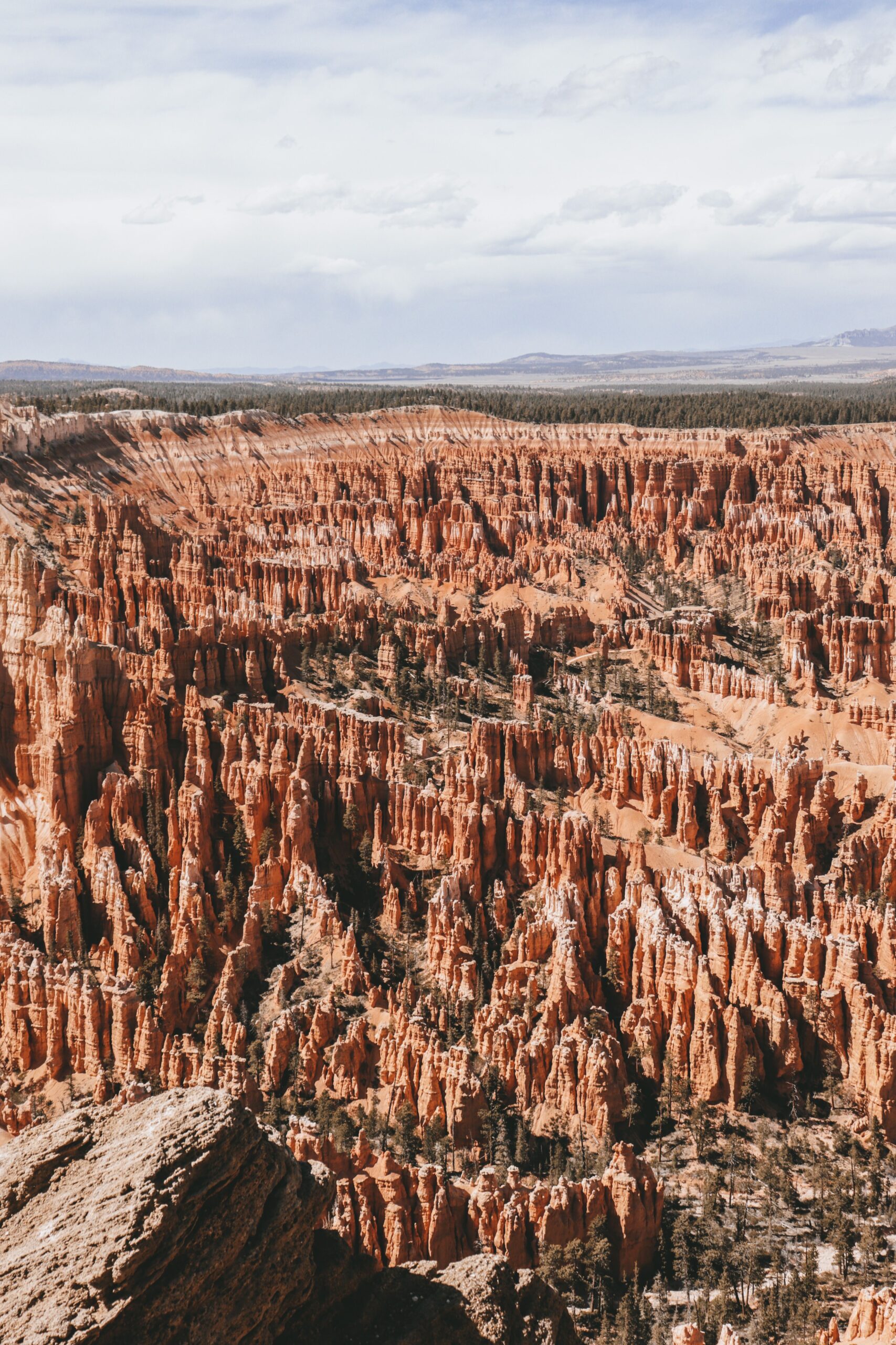
Inspiration Point & Bryce Point
Two short drives from the amphitheater, and each gives a completely different angle on the same bowl of hoodoos. Inspiration Point looks down the length of it; Bryce Point looks back across.
Sunset at Inspiration Point
The viewpoints all face east, so you won’t watch the sun drop into the canyon. What you get instead is the last light climbing back up the hoodoos — rangers point people to Inspiration Point or Paria View for it.
Best Photo SpotStargazing
Bryce is one of the darkest places in the country and runs night sky ranger programs through the season. Stay up for it — this is half the reason to sleep at the park rather than day-tripping from Zion. Guided stargazing tours go deeper if you want a telescope and someone who knows the sky.
Don’t MissEveryone photographs the hoodoos from the rim. The hike is what changes the trip — walking down among them is the only way to understand the scale.”
The Scenic Drive
Pack a Lunch First
There’s no food anywhere past the amphitheater. Grab sandwiches from the General Store before you head south or you’ll be driving back for them.
Drive Straight to Rainbow Point
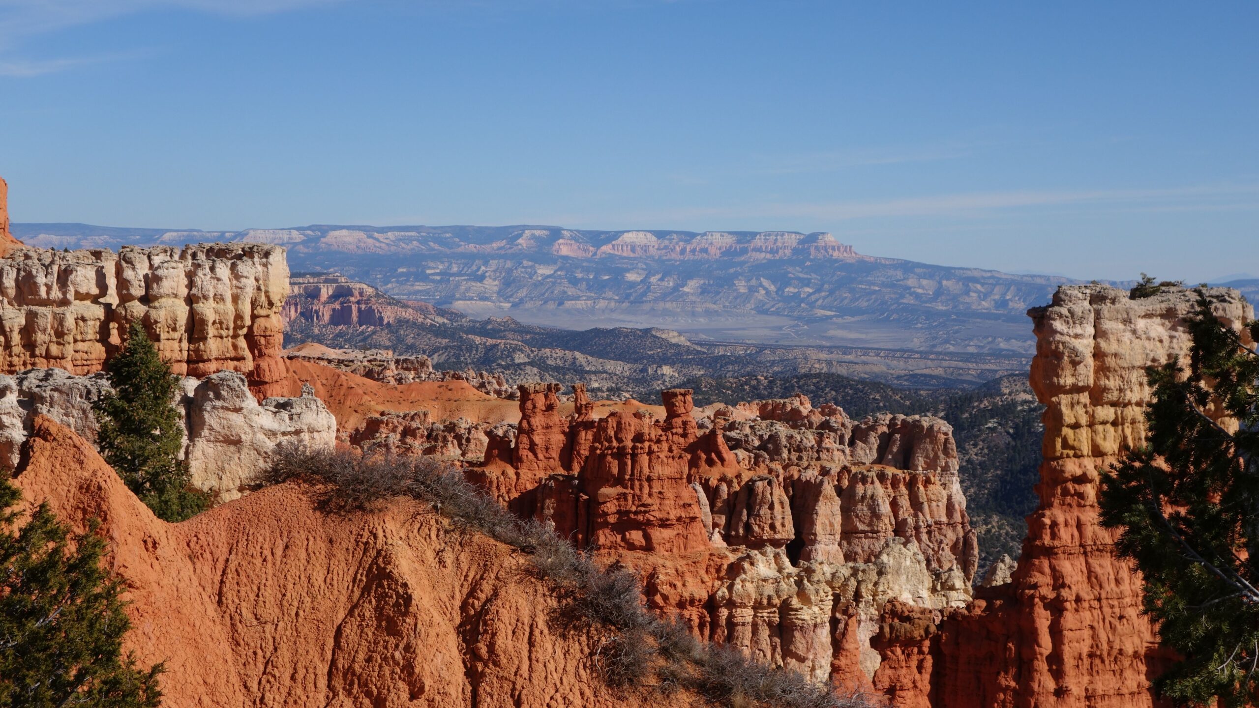
Eighteen miles to the end of the road, about 40 minutes without stopping. Drive it in one go, then work the viewpoints on the way back — every pullout is on the right-hand side heading north, so you never cross traffic.
Pro TipYovimpa Point & Picnic
A short walk from Rainbow Point with a view south across the Grand Staircase. Picnic tables and the best lunch spot in the park.
Family FavoriteWork Back Through the Viewpoints
Agua Canyon, Ponderosa Canyon, Natural Bridge, and Farview Point. Natural Bridge is a genuine arch a few steps from the parking area and the standout of the four.
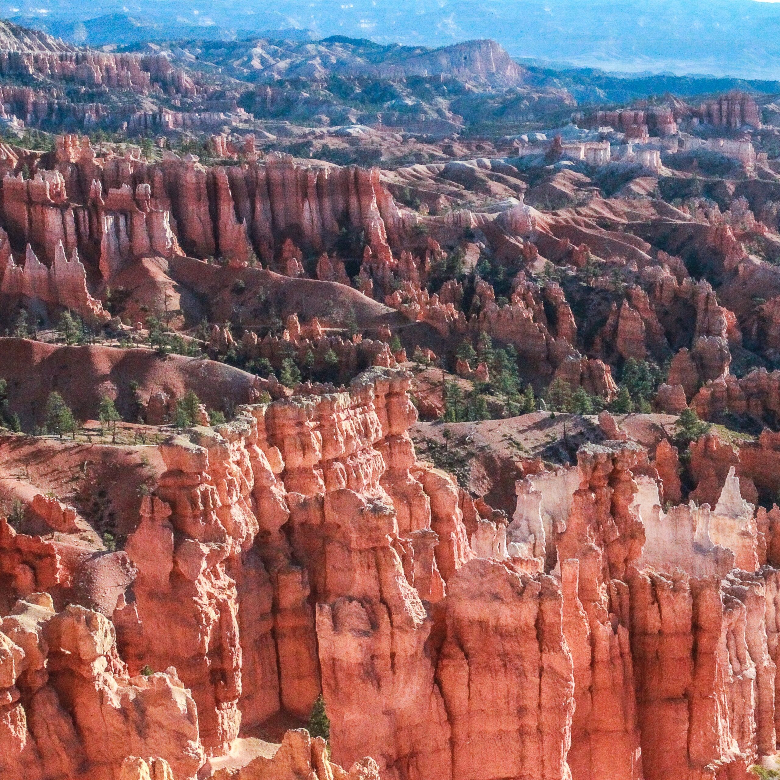
Mossy Cave or Fairyland Point
Two things almost nobody does. Mossy Cave sits outside the main entrance on Highway 12 — a short walk to a waterfall. Fairyland Point is before the fee booth, and it’s the quietest amphitheater view in the park.
Ashley’s PickDepart, or on to Capitol Reef
Salt Lake City and Las Vegas are both about four hours. Or keep going east on Scenic Byway 12 toward Capitol Reef — roughly 2.5 hours, and one of the best drives in the country.
Most visitors see the amphitheater and leave. The southern scenic drive takes half a day, has a fraction of the crowds, and ends 9,000 feet up looking across three states’ worth of desert.”
Where to Stay Near Bryce
This itinerary assumes you’re within a few minutes of the entrance so you can make sunrise. Our Where to Stay guide covers inside the park, Bryce Canyon City, and Tropic — plus glass-dome glamping under some of the darkest skies in the country.
Coming from Zion?
Bryce is about 1.5–2 hours east, and it’s the natural second stop on a Mighty 5 road trip. Our 3-day Zion itinerary and 2-day version both end pointing this direction.
Planning Notes
- Wall Street is closed after flood damage on July 29, 2026, with no reopening date announced. The Two Bridges side of the Navajo Loop is open and this itinerary routes you that way — but check current conditions before you travel.
- The shuttle doesn’t go south. It serves the amphitheater viewpoints only. Day 2’s scenic drive needs your own vehicle.
- The shuttle runs one direction. Board at Bryce Point and you go straight back to Inspiration Point; board at Inspiration and you ride the entire loop first.
- Altitude is real here. The rim is 8,000–9,115 ft. Drink more water than you think and take the climb out of the amphitheater slowly.
- Bryce Canyon Lodge books 13 months ahead and fills fast. If you want to sleep inside the park, that’s the window.
- Oversized vehicles aren’t permitted in the Sunrise and Sunset Point lots while the shuttle is running.
2-Day Bryce Canyon Itinerary FAQ
The questions we get asked most about planning a Bryce trip.
Is 2 days enough for Bryce Canyon?
Yes, comfortably. Bryce is one of the smaller national parks and the main amphitheater is compact. Two days covers a sunrise, the signature hike, the full 18-mile scenic drive, and a night of stargazing. One day works if you skip the scenic drive, but you’d be missing half the park.
Do I have to take the shuttle at Bryce Canyon?
No. This is the biggest difference from Zion. Bryce’s shuttle is entirely optional and you can drive the whole scenic road year-round. It runs roughly April through October and is mainly useful for avoiding viewpoint parking in midsummer.
Is Wall Street open?
Not currently. Heavy rainfall on July 29, 2026 caused extensive damage to the Wall Street side of the Navajo Loop and it’s closed while repairs are completed, with no reopening date announced. The Two Bridges side remains open, so the Queen’s Garden–Navajo loop still works. Wall Street also closes routinely in winter for ice and rockfall.
What’s the best hike in Bryce Canyon?
The Queen’s Garden–Navajo Combination, and it isn’t close. The Park Service calls it their most recommended hike for first-timers. It’s 2.9 miles with 625 feet of gain, takes 2–3 hours, and they suggest descending Queen’s Garden from Sunrise Point and climbing Navajo up to Sunset Point.
Where’s the best place to watch sunrise at Bryce?
Sunrise Point is the obvious answer and it’s a good one, but Sunset Point and Bryce Point are equally strong — the amphitheater faces east, so all of them catch first light. Sunrise Point is simply the most convenient if you’re staying at the lodge.
How high is Bryce Canyon?
The rim runs 8,000 to 9,115 feet, which makes it considerably higher than Zion. Expect cooler temperatures year-round, shortness of breath on the climb out of the amphitheater, and snow well into spring.
How far is Bryce Canyon from Zion?
About 1.5 to 2 hours. They’re the first two stops on a Mighty 5 road trip driven west to east, and the drive between them is straightforward.
Where should I stay for a 2-day Bryce trip?
Bryce Canyon City sits right outside the entrance and has the most options. Bryce Canyon Lodge is the only in-park lodging — reservations open 13 months ahead and go quickly.