3 Days in Arches & Canyonlands
Two parks, one Moab base, and an honest account of what each choice costs you in heat, driving, and the things you won’t get to.
📍 The short version
Day 1 is Arches. Day 2 is Island in the Sky and Dead Horse Point. Day 3 is a real choice, not filler.
Two things shape this entire itinerary, and most guides skip both. Arches is a single 18-mile dead-end road, so the only real decision is which direction you drive it — and that depends on when you hike Delicate Arch, which depends on the season. And Canyonlands isn’t one place: its districts are hours apart, so “visiting Canyonlands” means picking one.
Do I need a reservation for Arches in 2026?
No. The National Park Service lifted the Arches timed-entry requirement for 2026, announced February 18, 2026. There’s no ticket to buy and no entry window to hit.
But “no reservation” is not the same as “walk right in.” During peak periods — roughly 8 AM to 3 PM, spring through fall — parking areas and park roads fill, and NPS can temporarily restrict incoming traffic. Those restrictions have reportedly lasted three to five hours.
So arriving early still matters. Just for a different reason than it used to.
Reservations are still required for Devils Garden Campground and for Fiery Furnace, whether self-guided or ranger-led.
Last verified: August 2026 — recheck before you travelBefore You Go
- Entrance fees — Arches $30 per vehicle, Canyonlands $30 per vehicle, both good for 7 days. Two separate parks, two separate fees.
- Dead Horse Point is a state park — $20 per vehicle, up to 8 people. Neither park pass covers it.
- Water is scarce — in Arches, only at the visitor center and Devils Garden. Nothing at the Delicate Arch trailhead. At Island in the Sky, water is limited and may not be available at all.
- Summer is a safety problem, not a comfort problem — highs regularly top 100°F, and NPS advises against strenuous activity between 10 AM and 5 PM in extreme heat.
- Arches is longer than it looks — the visitor center to Devils Garden is 18 miles and roughly 45 minutes of driving.
- You don’t need 4WD for anything in this itinerary. You absolutely do for White Rim Road, Elephant Hill, and most unpaved routes.
The Arches Icons
Arches is an 18-mile dead-end road with everything hanging off it. There’s no loop and no shortcut. So the only real question is which direction you travel it — and the answer depends entirely on when you hike Delicate Arch. We’ve written this day twice. Use the version that matches your month.
| Season | Hike Delicate Arch | Why |
|---|---|---|
| June – September | First light | Safety. NPS advises avoiding strenuous activity 10 AM–5 PM in extreme heat |
| October – May | Late afternoon | Light. The arch faces west and glows in the last hour |
In 2026 alone, rangers responded to roughly 23 heat-related search-and-rescue incidents across Arches and Canyonlands, and NPS issued an extreme-heat warning on August 4. This isn’t the usual “start early to beat the crowds” line. Crowds are an inconvenience. Heat here is a hazard.
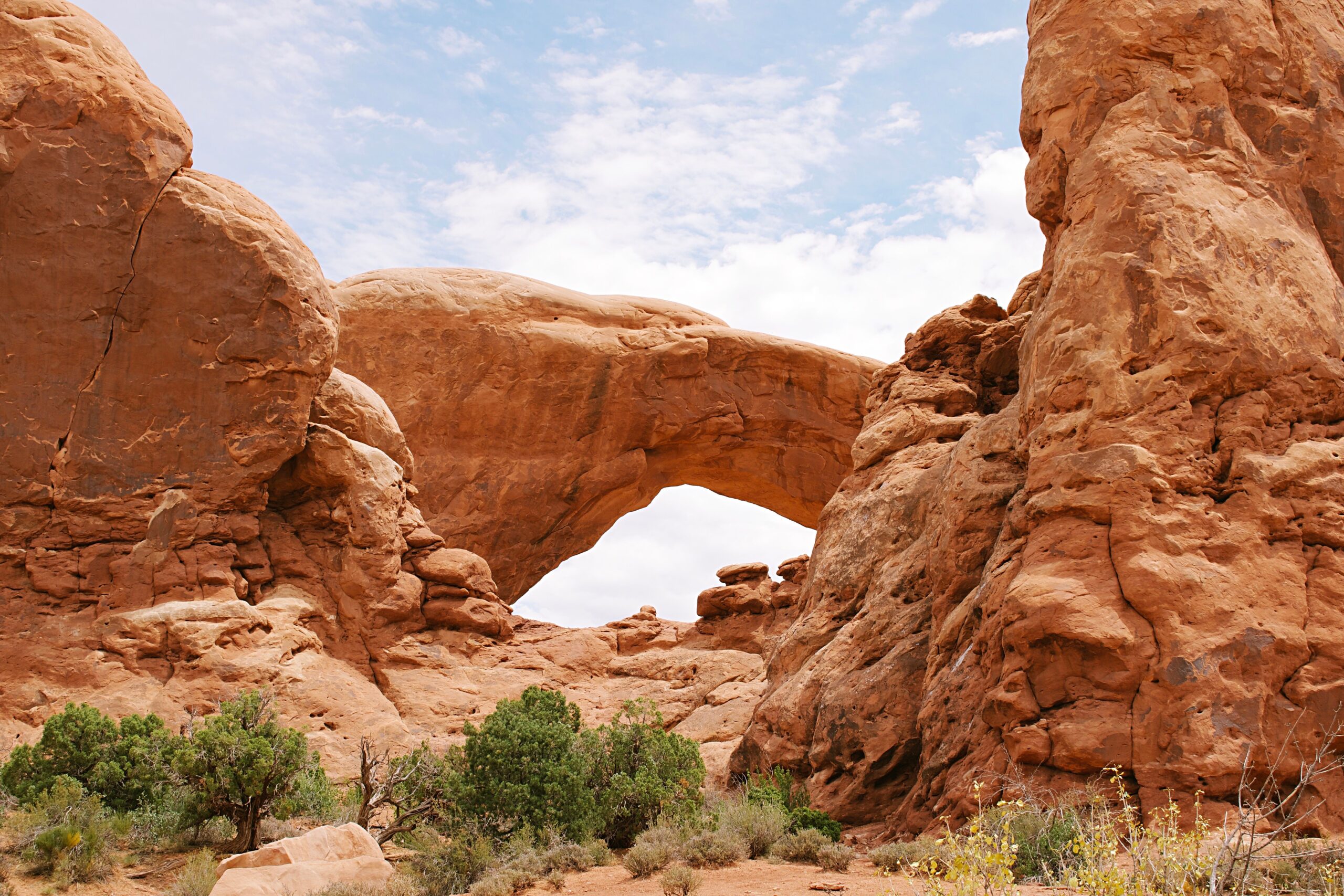
Run the park backwards
Drive straight to Wolfe Ranch
Moab to the Arches entrance is about 5 miles, then roughly 12 miles in to the Delicate Arch trailhead. Don’t stop for anything — you’ll see all of it on the way back out.
Fill your water before you leave. There is none at this trailhead. NPS recommends 2 to 3 liters per person for front-country hikes in extreme heat.
Delicate Arch
The mileage is not the hard part. NPS describes exposed slickrock, steep climbing, very limited shade, and a final ledge roughly 200 yards long with a drop on one side.
Be off the trail by 9 AM. If you’re not at the arch within an hour of sunrise, turn around — the climb out is the exposed part, and it’s the part that catches people.
Sand Dune Arch
A short walk between two fins and one of the only genuinely shaded spots in the park. Deep sand underfoot. Worth it in summer specifically because it’s cool.
The Windows & Double Arch
North Window, South Window, and Turret Arch sit together on one loop. Double Arch is a few minutes further along the same spur. Both are almost entirely unshaded.
If it’s already brutal, do Double Arch and skip the loop — it’s shorter and the more impressive of the two.
Balanced Rock, then Park Avenue — from the car
Both have roadside viewpoints. Park Avenue is a walk through a canyon of vertical fins, but by midday in July that’s a bad idea. The viewpoint gives you most of it.
Leave
Back to Moab. Out of the sun, drink water, eat something. This isn’t giving up — it’s how the day is designed to work.
Run the park forwards
Park Avenue
Worth knowing: this is point-to-point, with a trailhead at each end. With two cars or a willing driver, walk it one way. Otherwise you’re walking back or turning around partway. Most guides list it as “1 mile” and leave you to find out the rest.
Balanced Rock
A quick stop right off the road — a massive boulder perched on a slender pedestal.
The Windows & Double Arch
Three arches on one short loop, then the tallest and second-longest arch in the park a few minutes away.
Devils Garden — Landscape Arch
The far end of the road, 18 miles from the visitor center. Flat, straightforward, and a remarkable span of rock.
Everything past Landscape Arch changes character completely. The continuation to Double O Arch is 4 miles round trip with 275 feet of elevation change, and NPS rates it Strenuous — climbing steeply over sandstone slabs, uneven footing, narrow ledges with steep drop-offs. NPS says you’ll use your hands and feet. If that’s what you want, it’s a fine hike. If you assumed “4 miles” meant a longer version of Landscape Arch, it isn’t.
Back to Wolfe Ranch for Delicate Arch
About 6 miles back from Devils Garden. Aim to be at the arch roughly an hour before sunset — that’s when the west-facing sandstone turns.
Bring a headlamp for the descent. Slickrock is harder to read in fading light, and the final ledge is not where you want to be improvising.
The hard part of Delicate Arch isn’t the three miles. It’s the slickrock, the sun, and the last two hundred yards.”
Island in the Sky & Dead Horse Point
Canyonlands is not one park in any way that matters to your trip. It’s three districts separated by hours of driving — NPS says travel between them can take two to six hours depending on the route. Island in the Sky is the one 40 minutes from Moab. The Needles is 74 miles away. The Maze needs multiple days and a capable 4WD, and it isn’t happening on this trip.
Island in the Sky is built like a hand: one road up the mesa, splitting into two branches. Run the east branch to its end first, pick up the west branch coming back, and you’ll drive the district once instead of twice. Everything on foot happens before 11 AM.
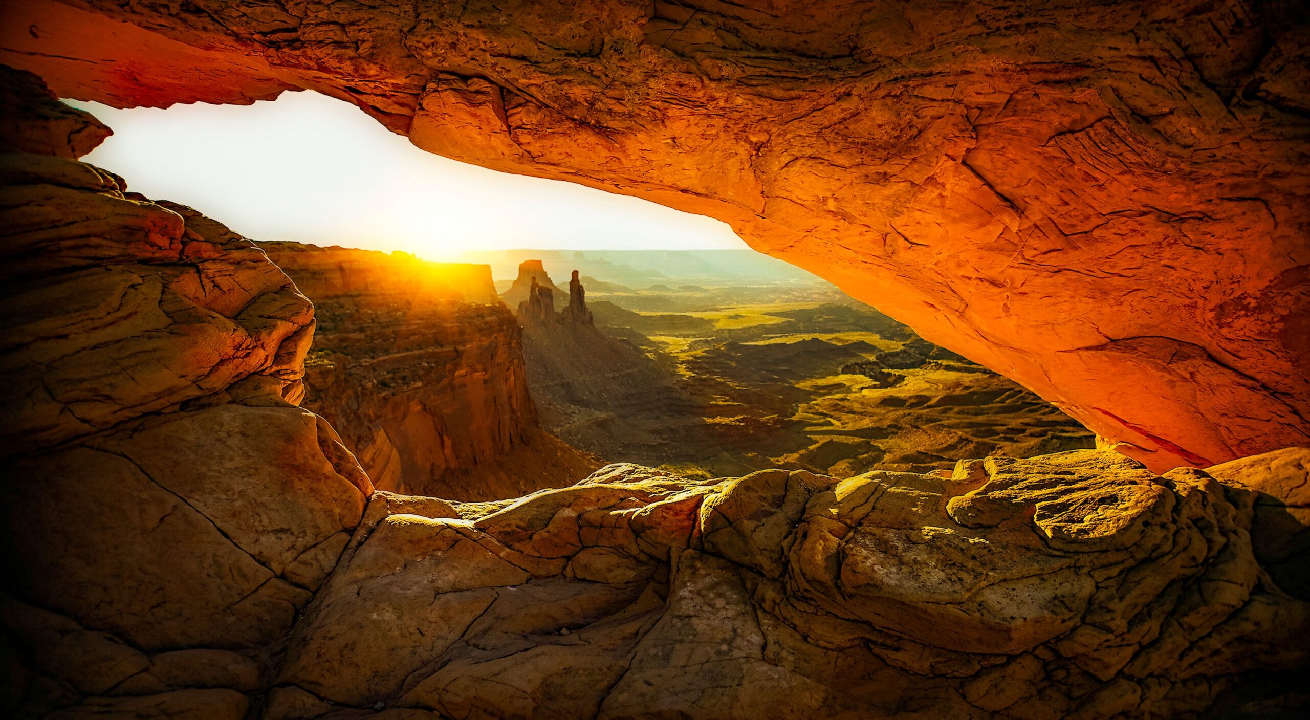
The sequence
Leave Moab
Leave Moab 90 minutes before sunrise. That covers the drive, the last few miles to the trailhead, the walk out, and getting a spot before the tripods do.
Fill water in Moab. Water at Island in the Sky is limited, may or may not be available at the visitor center depending on season, and isn’t available at any trailhead.
Mesa Arch
Sunrise light bounces off the canyon wall below and lights the underside of the arch orange, with towers framed through the opening.
The honest version: NPS itself notes that photographers gather here at sunrise. It’s the least-secret sunrise in Utah, and the front row is tripods, often three deep. Aim to be standing there an hour before sunrise in spring and fall, 45 minutes in summer, 30 in winter.
If you don’t care about the photograph, skip the alarm and come mid-morning. The crowd thins, the arch is still remarkable, and you’ll have slept. That’s a real option, not a consolation prize.
Grand View Point
The end of the east branch, and the best long view in the district — the trail runs the rim above Monument Basin with the White Rim bench far below.
Buck Canyon Overlook
A short paved walkway, wheelchair accessible, sweeping views west across the Colorado River canyon. Two minutes out of the car for one of the better views on the mesa.
Green River Overlook
Back to the junction and onto the west branch. The best view of the Green River from Island in the Sky, roughly 1,300 feet below, with the White Rim Road visible and the Maze district beyond.
Remember this one — NPS names it among the best sunset spots in the district, and that matters at the end of the day.
Upheaval Dome, first overlook
A crater of upended rock that geologists argued over for decades — collapsed salt dome, or meteorite impact. The second overlook adds about another mile and 50 feet, and the view is better. Take it if the heat hasn’t arrived.
Back to Moab
Heat break. Refill water. Eat.
Grand View Point is closed on weekdays until October 1
July 27 – October 1, 2026: closed Monday 6:00 AM through Thursday 4:00 PM. The overlook, the trail, and the final 0.3 mile of road are all closed — no vehicle, bicycle, or pedestrian access. It reopens Thursday around 4:00 PM and stays open through the weekend.
Substitute: White Rim Overlook. 1.8 miles round trip, 159 feet of elevation change, Easy. NPS specifically names it as a good alternative to Grand View, with similar views over Monument Basin. Parking is very limited — during the closure window, arrive before 9 AM.
NPS expects further construction phases, including in 2027.
Last verified: August 2026 — recheck before you travelDead Horse Point
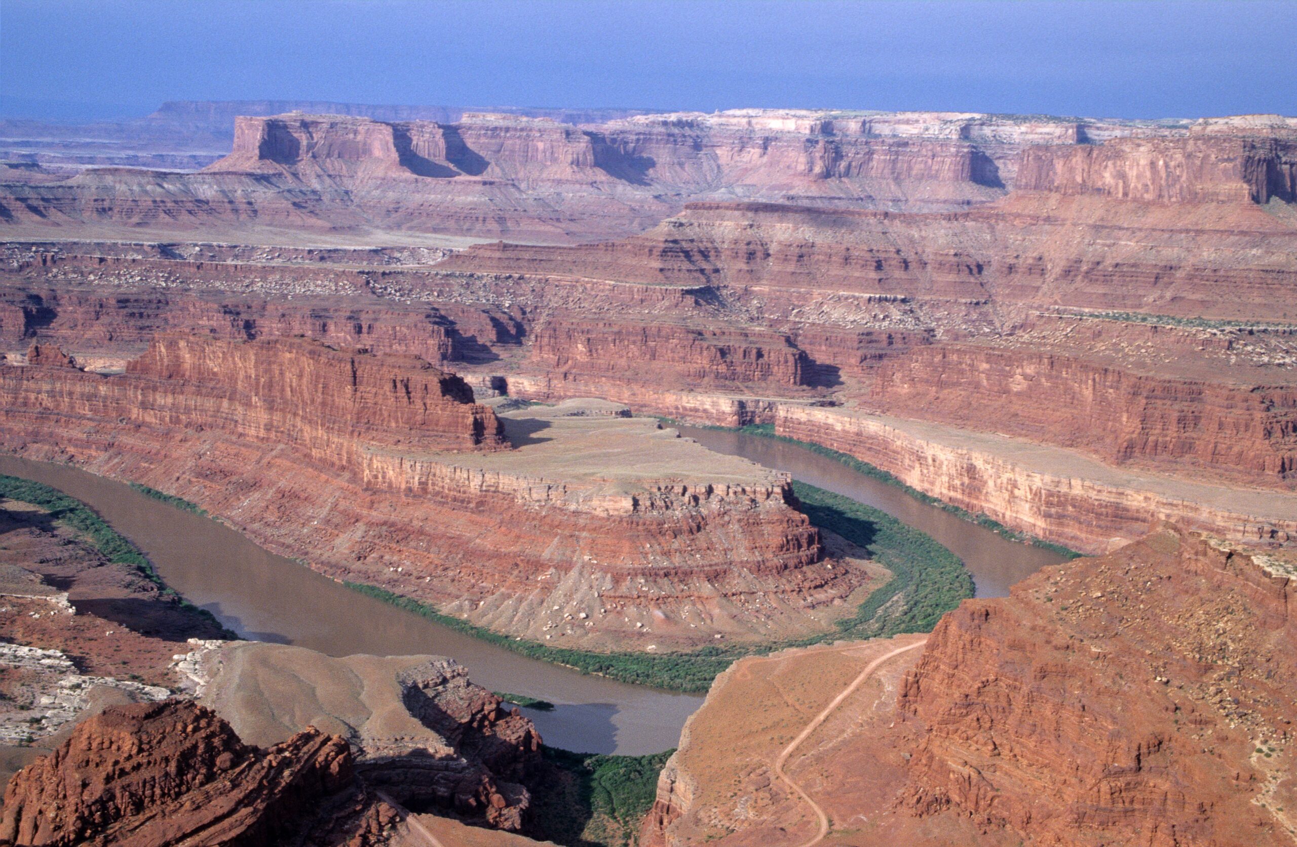
Dead Horse Point State Park
This is a Utah State Park, not part of Canyonlands. Your $30 Canyonlands entry does nothing here, and neither does an America the Beautiful pass.
Is it worth the extra $20? For most first-timers, yes. The overlook sits high above a gooseneck bend in the Colorado, and it’s a view Island in the Sky has no equivalent to. It’s about 30 minutes from Grand View Point on the way back toward Moab, so you’re barely detouring.
When it isn’t: if you’re already done after a full day on the mesa, on a tight budget, or with kids who’ve hit their limit. Green River Overlook is the alternative — free, inside the park you already paid for, and NPS calls it one of the best sunset spots at Island in the Sky. You are not settling.
Choose Your Adventure
Most three-day itineraries pad the last day. This one gives you a genuine choice, because the right third day depends on what kind of traveler you are and on what the first two days did to you.
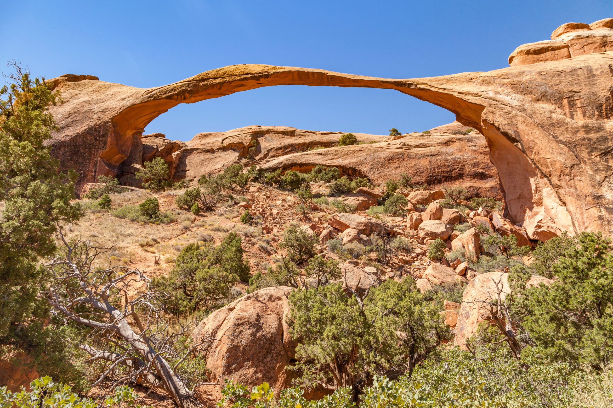 Option A · The default
More Arches
Go back for what you missed and go deeper into Devils Garden than Day 1 allowed. This absorbs anything heat or crowds cut short — which is why it’s the right pick if you’re unsure.
| Route | Distance | Reality |
|---|---|---|
| Landscape Arch | 1.9 mi · Easy | Flat and straightforward. What most people should do |
| Double O Arch | 4 mi · 275 ft · Strenuous | Real scrambling, narrow ledges, drop-offs |
| Primitive Loop | 6.6–7.9 mi · Difficult | Experienced hikers, cool weather only |
 Option B · A full day
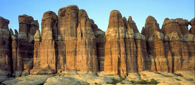
The Needles
74 miles and about 1.5 hours from Moab, each way. Three hours of driving is the price of admission, and it’s why this is a whole day rather than an afternoon.
What you get for it: a completely different landscape — banded red-and-white spires instead of arches and mesas — and a fraction of the people.
The easier day: Roadside Ruin, the Cave Spring loop past a historic cowboy camp and pictographs, Pothole Point, and the Wooden Shoe and Big Spring Canyon overlooks. Roughly two miles of walking spread across the day.
The hiking day: Chesler Park Viewpoint at 5.8 miles and 3–4 hours, or the full loop with the Joint Trail at 10.7 miles and 5–7 hours for strong hikers with an early start.
Don’t pick this ifDay 1 got cut short and you haven’t finished Arches. Option A is the better use of the time. And Chesler Park is not required to make the Needles worthwhile — most guides imply otherwise.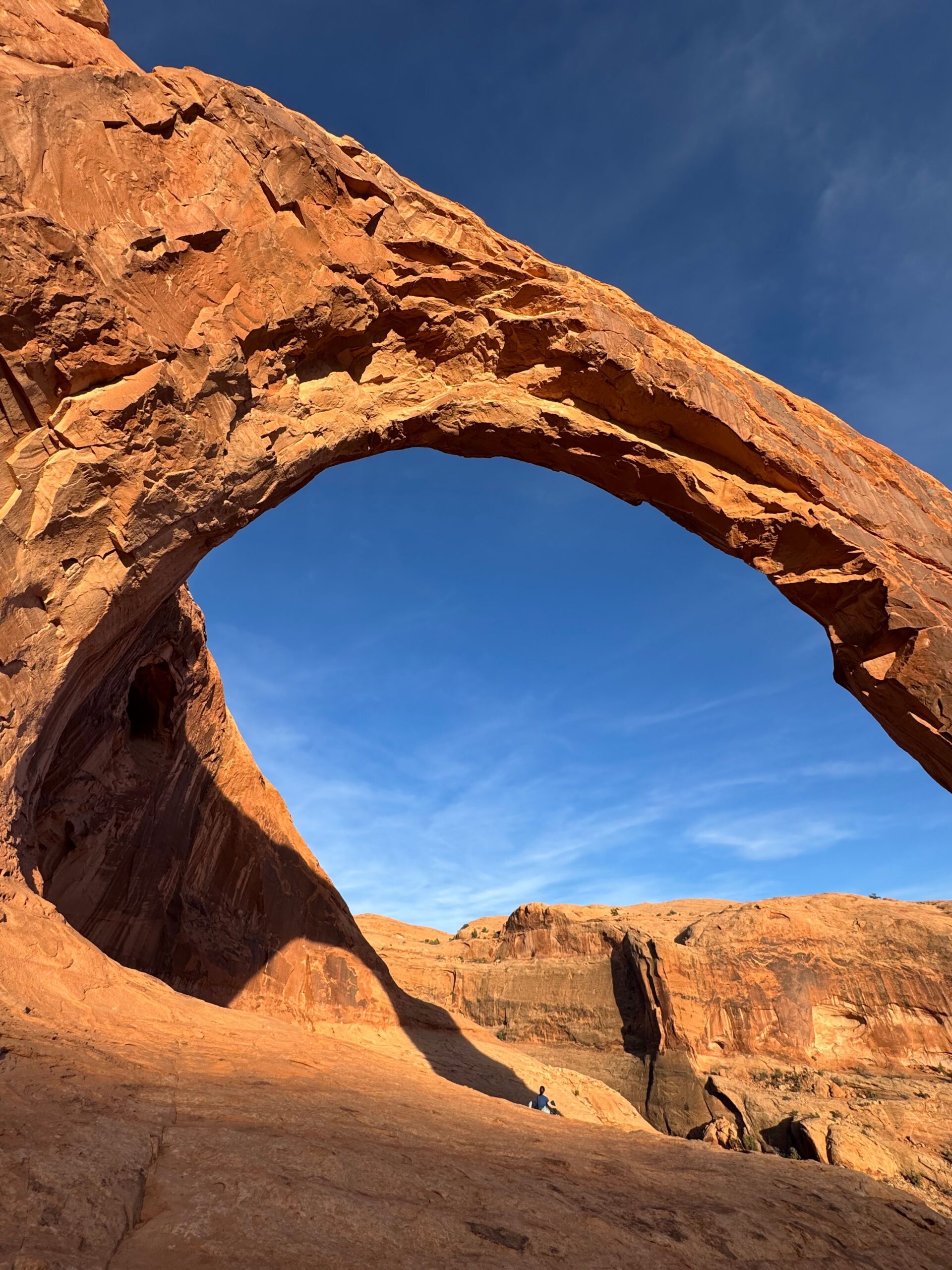 Option C · Pick one
The Day Off That Isn’t Wasted
Corona Arch. On BLM land off Potash Road — 3 miles round trip, moderately strenuous, no fee and no permit. An arch the size of the ones inside the park, without the park. The route includes two safety-cable sections and a short ladder over a ledge, which sounds alarming and isn’t, but know it before you bring anyone nervous about exposure.
Rafting. Half-day on the Colorado, morning departure. The only way to see the canyon from the bottom, and the one thing here you genuinely can’t do yourself.
Or do neitherAfter two dawn starts and a lot of heat, a morning off in Moab is a legitimate itinerary choice. We’re not going to pretend otherwise.What three days costs you
You will not see the Maze. You probably won’t do Fiery Furnace — it needs a permit booked within seven days, picked up in person at the visitor center, plus a mandatory orientation, and building a first-time trip around that much friction isn’t worth it.
If you pick the Needles you’ll skip the second half of Devils Garden. If you pick Devils Garden you won’t see the Needles at all. Tower Arch and the Klondike Bluffs need a rough road we’re not sending you down.
That’s the actual trade, and no itinerary makes it disappear. Three days in Moab buys you two parks done properly and one real choice. Four days buys you the choice you didn’t make.
Which pass actually saves you money
Moab only? Arches and Canyonlands are $30 each, so $60 at the gates. The Southeast Utah Parks Annual Pass is $55 and also covers Natural Bridges and Hovenweep.
Doing the Mighty 5? Individual entry across all five runs $150. The America the Beautiful annual pass is $80. Not close.
Visiting from outside the US? As of 2026 there’s a $100 surcharge per non-US resident aged 16 and up at Zion and Bryce Canyon. It does not apply at Arches, Canyonlands, or Capitol Reef. The Non-Resident Annual Pass is $250 — if you’re visiting Zion or Bryce with more than two adults, that pass costs less than the surcharges alone.
Heat, Water & Flash Floods
- Summer highs regularly exceed 100°F. NPS advises avoiding strenuous activity between roughly 10 AM and 5 PM during extreme heat.
- Carry 2–3 litres per person for front-country hikes in extreme heat, and at least 4 for backcountry travel.
- Fill water before you enter either park. Arches has water at the visitor center and Devils Garden only. Island in the Sky has none at trailheads.
- Late summer is monsoon season. NPS warns flash floods can happen when the sky above you is clear — the risk is in washes and canyons, and Fiery Furnace closes for flooding.
- Open slickrock is a different hazard — Delicate Arch and the mesa-top trails expose you to lightning and heat rather than water.
- Spring and fall are the strongest seasons for hiking, with daytime highs roughly 60–80°F.
What to pack
Desert hiking in two parks with almost no shade and very little water changes what belongs in your bag. Our Gear Guide covers the picks we actually use — daypacks, sun protection, water capacity, and boots that handle slickrock.
Planning the rest of the Mighty 5?
Arches and Canyonlands are the eastern end of the run. Start with Zion, then Bryce Canyon, and work east on Highway 12.